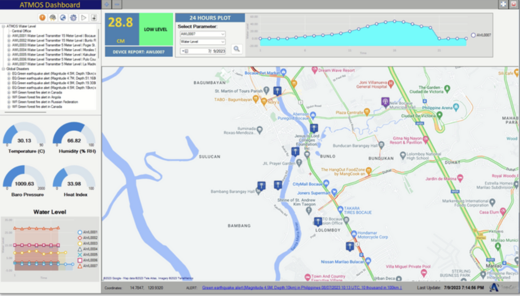
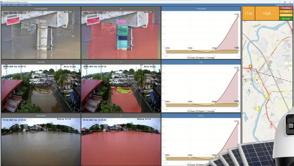
Locally developed operating software and API interface that records and displays specific information like MAP Display of Sensors, Warning Display of Flooding, Water Level, Temperature, Humidity, Heat Index, Barometric Pressure and it also display Global Disaster and Traffic Information and many more.
The Advance Dashboard contains instrument clusters and the Water level notification and Advisory if Water level has reached Flooding Limits, High tide, and Low Tide Level.